
Earth Imaging & Sounding
Building a picture of the subsurface
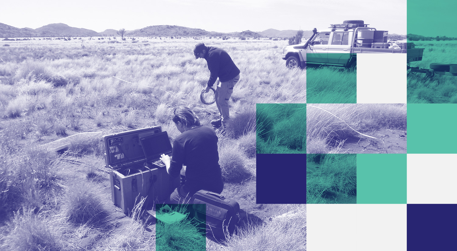
Deploying AusLAMP magnetotelluric equipment near the Musgrave Ranges, SA: Philippa Mawby of Adelaide Uni and Sam Henschke of Helifarm. Image: Dr. Bruce Goleby.
How do we see into the Australian continent? And what does it tell us?
Like an x-ray for humans, we scan the Earth— but with specialist geophysical equipment to build up a clear and rich picture of our entire continent’s subsurface, from a few meters to 100’s, even 1000’s of kilometres deep.
We collect new data where none are currently available or have never been collected. These datasets are used in many research and natural resources exploration applications and are available from our FDSN Data Centre AusPass.
Overview
AuScope Earth Imaging builds upon existing national geophysical datasets developed by Geoscience Australia, ANU, ANSIR and others, providing an increasingly clear and rich picture of the subsurface of our continent. Over the years, we have invested in:
An upgrade and expansion of existing passive seismic and magnetotelluric (MT) equipment to present state-of-the-art gear. This includes development of new broadband seismic recorder systems at the ANU, 3-component seismic nodes, DAS, MT broadband systems, and MT low frequency systems based at the University of Adelaide.
AusPASS is a FDSN data centre dedicated to the acquisition, management and distribution of pass seismological data in Australia and surrounds. Extensive fieldwork projects and experiments have been conducted across the country and in New Zealand and Indonesia. These distinct seismic arrays (groups of seismic stations), both legacy and current, are now available through AusPass. More data are perpetually being added, so check back regularly for updates.
The acquisition of ~250 line-km per annum of seismic (reflection and portable instrument) and MT imaging. The AuScope investment enables the university-based research community to have a seat at the proposed National GeoTransect planning table, and to use its 250 line-km contribution to leverage access to a much larger Earth Imaging dataset.
Our toolkit
AuScope Earth Imaging has invested in fleets of seismometers & seismic data loggers, ocean bottom seismometers (OBS), nodal seismometers, Distributed Acoustic Sensing (DAS) interrogators, and magnetotelluric (MT) field instruments. The data from these instruments are archived and available at our FDSN Data Centre AusPass.
What we’re working on
We are currently working on:
Collecting and processing datasets for the Curnamona cube
Distributed Acoustic Sensing (DAS) experiment across the Alpine Fault
Analysing data from the Macquarie Ridge OBS experiment
Collecting data for the Aus Array Program in South Australia and Western Australia
F.A.I.R. passive seismic datasets archived at the FDSN AusPass Data Centre.
Achievements
Since 2006, we have renewed and grown capacity for broad-band seismic recording and, built up a national capacity for magnetotelluric studies both onshore and offshore.
We have also invested in geotransects as a contribution to data infrastructure, as recommended in the 2003 National Strategic Plan for Geoscience. This has resulted in a major increase in the coverage of the continent through detailed full crustal reflection profiles, and had both scientific and economic importance.
Australia is a significant player in the International Seismology Community as it led deploying “rolling” arrays across the Australian continent starting in the early 1990s with the Skippy Project experiment and have continued with the BILBY, TIGGER, WOMBAT and subsequent experiments.
In mid-2018 we launched the FDSN data centre AusPass, in which ~35 years worth of archived passive seismic data, including the continental scale legacy experiments, are now openly available through this portal.

Future
The international trend in deployments of portable seismic instrumentation is to use large numbers of instruments with many cooperating institutions. Our Australian Earth Imaging community is small but very active and growing, and is being challenged by this trend. The typical quantum used in current experiments supported by AuScope is 20-30 long-term solar powered seismic stations and/or ~100 seismic nodes, depending on their spatial distribution. These numbers represent what we can reasonably deploy but larger configurations may be possible.
More recently, new developments in seismology, called “large-N” arrays, use nodal-type seismic instrumentation. Large-N refers to 1-2 orders of magnitude more instruments per experiment and nodal refers to the small (paint can) size. This new technology is transforming how we acquire data and will end spatial aliasing, providing much higher resolution and a broad range of applications. These instruments can be utilised in quick deployment after a regional earthquake (aka RAMP studies), monitoring induced seismicity, and many other important scientific applications. Earth Imaging now has 260 short period nodes and 100 broadband nodes.
As well as supporting core seismic imaging work in Australia, portable seismic instruments have become increasingly used in the surrounding regions (e.g. New Zealand and Indonesia) to help address fundamental issues such as seismic and tsunamigenic hazards.
Access to instrumentation
Access to the portable seismic and MT equipment is through the submission of a short scientific proposal assessed by the ANSIR Access Committee based on scientific merit and instrument availability.
News


Further reading
PROGRAM LEADER
Prof. Meghan Miller
Australian National Uni
For more information on current and potential projects please get in touch with Meghan.
PROJECT LEADERS
Dr. Graham Heinson
Adelaide Univeristy
Dr Robert Pickle
Australian National University
DURATION
Since 2006
QUICK LINKS
AuSIS website, Facebook
and Twitter pages
ACCESS TOOLS & DATA
ANSIR Research Facilities
for Earth Sounding
Passive Seismic Data and Data Products available via AusPASS
IN THE MEDIA

