
FAIR hike for worthy cores

Over 32 kilometres of drill core have been taken from remote NSW to Londonderry for hyperspectral analysis and liberation of voluminous mineralogy data for mineral exploration. Great work, GSNSW. Image: Jake Moltzen, GSNSW
In the last five years, the Geological Survey of NSW (GSNSW) has coordinated the transport of over 32 kilometres of geological drill core from remote corners of the state to Londonderry’s WB Clarke Geoscience Centre for hyperspectral mineralogy analysis.
Why? To provide volumes of new, F.A.I.R (findable, accessible, interoperable and reusable) data to geologists working to better understand NSW geology and improve prospectivity of critical minerals in Australia. This NCRIS enabled project represents a significant step forward for GSNSW in terms of scale, collaboration and emergent scientific opportunities. Here we reflect on the GSNSW-led collaboration with AuScope, CSIRO and other partners across academia, government and industry.
Responding to the challenge
Since their deployment by CSIRO and AuScope between 2007 and 2008, the HyLoggerTM instruments have been generating highly valuable data from drill core across the country. However, there have been barriers to optimising their use. AuScope CEO, Dr Tim Rawling explains:
“Due to the relatively high cost of transporting either the instruments to remote drilling sites, or the drill core to central core analysis facilities, it has been challenging to maximise the value of the HyLoggerTM instruments — a common geographic challenge for mineral exploration across this continent at large.”
To address this issue, AuScope worked with GSNSW, CSIRO and other collaborators to identify and then collect important remote collections of core from Broken Hill, North Parkes, Cobar, Tritton, McPhillamys and Discovery Ridge for analysis at Londonderry.

Map of NSW showing source of drill core (yellow dots) that the GSNSW team has transported to Londonderry (orange dot) in the last five years using the NVCL funds. Image: Peter Bukey, GSNSW
Jake Moltzen, Senior Geoscientist Spectral in the Mineral Systems Group at GSNSW reflects:
“Through this project we have been able to acquire and analyse highly valuable mineralised drill core and set up industry collaboration that would not have been possible without the use of drill core moving funds, while also enabling us to make otherwise unavailable information on NSW mineral systems public, which is highly valued by current and prospective mineral explorers.”

Drill core arriving at Londonderry Core Library (WB Clarke Geoscience Centre) from Cobar. Image: Jake Moltzen, GSNSW
Making an impact
Some of GSNSW’s recent highlights from this project include characterisation of:
alteration response to mineralisation and regional metamorphism in the Cobar mineral district (direct dating of mineralisation and paleontological studies are ongoing through this project), and
alteration response for the McPhillamys-Discovery Ridge gold projects (direct dating of mineralisation as well as petrographic and isotopic studies are ongoing through this project).

Preparing drill core for hyperspectral analysis using the AuScope funded HyLoggerTM instrument. Image: Jake Moltzen, GSNSW
Further, GSNSW has seen positive flow-on effects, with the additional drill core acquired allowing for important 3D modelling to be undertaken. Dr Phillip Blevin, Manager of the Mineral Systems team at GSNSW, explains how this NCRIS support has helped to increase his team’s understanding of different NSW mineral systems and the associated characteristics:
“The additional drill core acquired has helped provide enough density of data to undertake more exploratory 3D modelling of alteration and mineralisation envelopes around NSW mineral systems. The result is momentous for the mineral exploration community in the state and we look forward to opportunities that this project might enable in the next few years.”
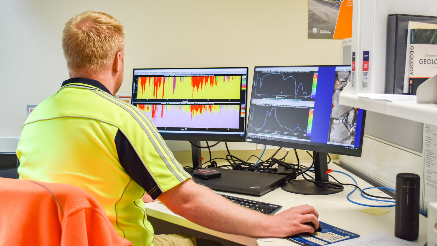
Processing hyperspectral data using the AuScope-funded HyLoggerTM instrument using The Spectral GeologistTM software. Image: Jake Moltzen, GSNSW
And finally, Dr Joel Fitzherbert, Senior Metallogenic Geoscientist in the Mineral Systems team at GSNSW, describes how the unprecedented access and collaboration in this project have been the catalyst for many follow-on mineral system studies, and the major recent source of samples used by the GSNSW team:
“We have been able to take advantage of previously unavailable drill core samples from these projects to undertake petrographic, geochronological, isotopic and paleontological characterisation of the mineralised regions of NSW. It’s awesome!”
AUTHORS
Jo Condon and Jake Moltzen
LEARN MORE
About this or future projects, please contact Jake Moltzen; or, access GSNSW drill core scanning services
ACCESS DATA
View drill hole data via the AuScope Portal, view hyperspectral data via the GSNSW MinView portal (search: ‘NVCL HyLoggerTM drill holes’), and view summary data via CorStruth